The median home price across Portland sits at approximately $524,000 as of May 2026. Buyers entering the Multnomah County market will find a stark contrast in pricing and housing types depending on which side of the Willamette River they search. Condos dominate the urban core, while historic single-family homes define the outer residential grids.
Transit infrastructure dictates daily routines for most residents here. The MAX Light Rail, Portland Streetcar, and extensive TriMet bus network connect the outer suburbs to Downtown Portland. Understanding how the city is divided helps narrow down where to focus a property search.
How Portland's Five Quadrants Work
The Willamette River and Burnside Street divide the city into five distinct sections: Northwest, Southwest, Northeast, Southeast, and North Portland. Addresses include a directional prefix, making it easy to pinpoint a home's location on a map. North Portland sits on a peninsula formed by the Willamette and Columbia rivers.
Commute times to Downtown Portland or the tech hubs in the Washington County suburbs vary significantly by quadrant. Highway 26 serves the western suburbs, while Interstate 84 carries traffic from the east. Buyers should map their daily commute during rush hour rather than relying on off-peak drive times.
Living in Northwest Portland
The Pearl District offers some of the most concentrated condo inventory in the city, with median prices ranging from $330,000 to $400,000. Renters in this specific area pay an average of $2,150 per month. The architecture largely consists of modern high-rise buildings and converted warehouse lofts with exposed brick interiors.
Transit access is a primary draw for residents in this sector. The Portland Streetcar loops directly through the neighborhood, and the MAX Light Rail provides connections to the broader metropolitan area. Pioneer Courthouse Square and Washington Park sit just a short distance away, offering immediate access to public plazas and forested trails.
Nob Hill and School Boundaries
Moving slightly west from the Pearl District brings buyers into Nob Hill, where historic multi-story homes line the grid. This area falls within the Lincoln High School cluster of the Portland Public Schools district. Property lines often feature minimal setbacks, keeping the neighborhood dense and walkable.
Parking in Nob Hill requires a city-issued permit for street spots, and off-street parking adds a premium to listing prices. Buyers should verify whether a condo or single-family home includes a dedicated garage before making an offer.
Southwest Portland Housing
Driving from Multnomah Village to Downtown Portland via Interstate 5 takes roughly 12 to 15 minutes without traffic delays. This quadrant features winding, tree-lined roads that break away from the standard city grid. Housing styles shift noticeably here, with cottage-style homes occupying larger, forested lots.
Medical professionals often target Southwest Portland due to its physical proximity to Oregon Health & Science University (OHSU). The campus sits on Marquam Hill, and nearby properties offer quick access via specific TriMet bus routes. The MAX lines also serve the lower elevations of the Southwest quadrant.
Goose Hollow and Multnomah Village
Goose Hollow sits at the base of the West Hills, featuring mid-rise condo buildings and older residential properties. The MAX Blue and Red lines cut directly through the neighborhood, providing a direct rail link to the city center and the western suburbs.
Multnomah Village functions as a standalone commercial center further south. The Portland Public Schools boundaries here dictate assignments to specific elementary and middle schools, which buyers should map out on the district's website. The local streets favor pedestrians, though sidewalks are occasionally absent on residential cross-streets.
Southeast Portland Homes
Laurelhurst commands some of the highest residential prices on the east side, with median home values sitting between $875,000 and $901,000 in May 2026. Sellwood-Moreland offers a lower entry point, where median prices range from $532,000 to $646,000. Renters in Sellwood pay around $1,650 per month for standard apartments.
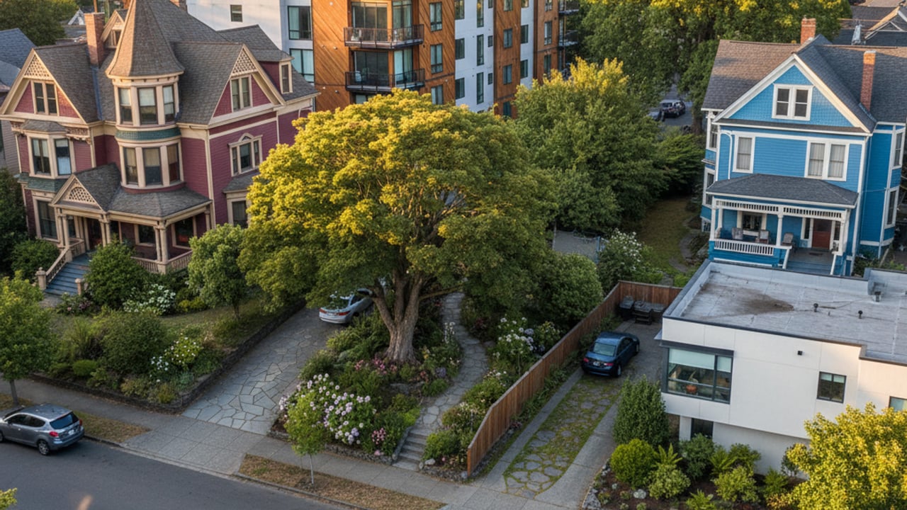
Historic Craftsman bungalows with deep porches define the Laurelhurst landscape. Sellwood-Moreland features a higher concentration of Victorian homes and early 20th-century builds. Both areas connect to the city center via the MAX Orange Line, which crosses the Willamette River into Downtown Portland.
Parks and Local Amenities
Laurelhurst Park provides 31 acres of paved paths, a spring-fed pond, and dense tree canopies. Further east, Mount Tabor offers hiking trails on a dormant volcanic cinder cone. The Hawthorne commercial street runs through the middle of the quadrant, lined with local retail spaces and restaurants.
Properties in the northern section of Southeast Portland typically fall within the Grant High School cluster. Buyers should review the exact boundary lines, as they weave through the residential blocks and can dictate long-term property values.
Northeast Portland Real Estate
The median home price around the Alberta Arts District ranges from $450,000 to $600,000. This quadrant blends historic bungalows with new modern infill construction. Developers frequently replace older, smaller structures with tall, narrow homes designed to maximize standard city lots.
Interstate 84 forms the southern border of Northeast Portland, providing a direct route for regional commutes. The local TriMet bus network handles the bulk of public transit within the neighborhoods themselves. The Portland Public Schools district boundaries segment the area into several different elementary and middle school zones.
The Alberta Street Corridor
Alberta Street serves as the primary commercial artery for the surrounding residential blocks. The street features a continuous line of art galleries, independent restaurants, and retail storefronts. The density of commercial spaces allows residents to complete daily errands on foot.
Street parking along Alberta can fill up quickly during weekends and evening hours. Buyers looking at properties one or two blocks off the main corridor should check for dedicated driveways, as street parking overflow affects the immediate residential streets.
North Portland Options
Multnomah County assesses property taxes based on a complex formula where the assessed value is often lower than the real market value. The effective tax rate hovers around $24 to $27 per $1,000 of assessed value, depending on exact bond measures. Buyers should ask their agent to pull the specific tax history for any North Portland property.
The Mississippi District features historic Victorians sitting alongside newer, multi-unit apartment buildings. The area sits on a bluff above the Willamette River, offering industrial views and access to waterfront paths. Commuting into Downtown Portland requires a short drive down Interstate 5 or a ride on the MAX Yellow Line.
The Mississippi Commercial District
Mississippi Avenue holds a dense collection of music venues, food cart pods, and retail shops. The surrounding residential streets transition rapidly from commercial zoning to single-family homes. The Portland Public Schools boundary designations here assign students to Jefferson High School or Roosevelt High School, depending on the exact street address.
The topography of North Portland is relatively flat compared to the western quadrants. Biking is a common method of transportation, and dedicated bike lanes connect the Mississippi District to the Broadway Bridge for access to the city center.
Frequently Asked Questions
What is the median home price in Portland, Oregon?
The citywide median home price is approximately $524,000 as of mid-2026. Prices vary widely by location, dropping closer to $350,000 for condos in the urban core and exceeding $875,000 for single-family homes in historic eastside areas.
Which Portland neighborhoods have MAX Light Rail access?
The Pearl District, Goose Hollow, and Sellwood-Moreland all feature direct access to various MAX lines. The Blue and Red lines serve the west side, the Yellow line runs north, and the Orange line connects the southeast suburbs to the city center.
How do property taxes work in Multnomah County?
Property taxes are calculated using an assessed value that is typically lower than the actual market purchase price. Voters regularly pass local bond measures, which means the final tax bill varies depending on the specific school district and neighborhood boundaries.